Urban concept and analysis
Girlan
A redevelopment plan for the residential historic town center of Girlan.
Role Role not stated in supplied portfolio
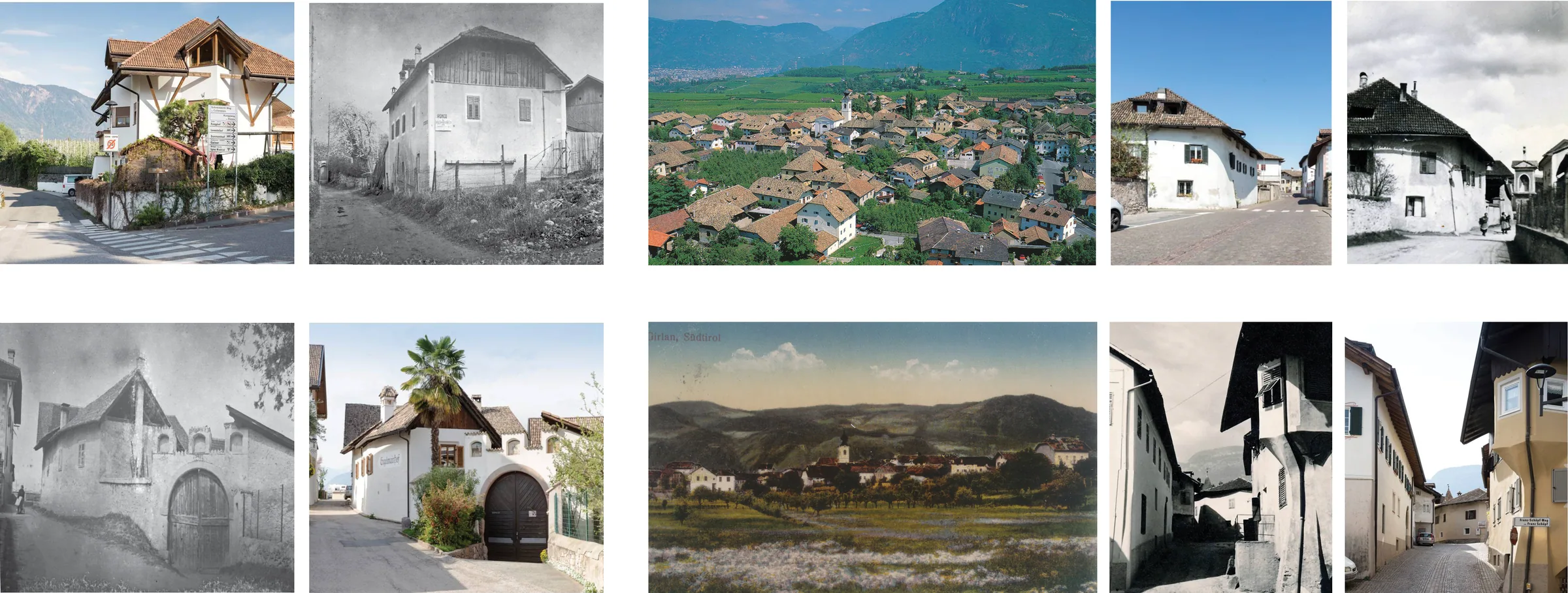
Regeneration through the existing fabric
Developed alongside the regeneration plan for Girlan’s historic centre, the urban concept establishes a strategic framework for strengthening the village’s spatial, social, and economic foundations while respecting its centuries-old, organically evolved structure.
The historical analysis reveals a settlement rich in architectural and cultural value, yet marked by structural and functional challenges that call for carefully guided development. Planning within a historic core asks for a more nuanced process than conventional residential zones, so the concept starts from a sensitive approach to the existing heritage.
Rather than imposing transformation, the concept works with the existing fabric to find latent potential for renewal and adaptation. The strategy is organised around three defining spatial typologies of historic settlements — public space, built space, and green space — with targeted interventions for each that emphasise their interdependencies and collective impact.
Mobility, social inclusion, and climate resilience are integrated with the preservation of architectural character. The aim is to reactivate the historic centre as a vibrant, resilient living environment that balances continuity and change and sustains its cultural and spatial identity for residents and visitors.
Three systems, one historic centre
Public space includes meeting places such as squares and areas for staying, the forecourts of retail and hospitality venues, and mobility infrastructure such as streets, parking areas, and bus stops. These spaces serve collective use but are partly shaped by competing demands.
Built space is the built environment, including public facilities, and so represents both the public and the private life of Girlan’s residents. The diverse historic building stock, walls, fountains, and alleyways is an important identity-forming element of the town.
Green space forms an important ecological network. It includes large-scale elements such as playgrounds, private gardens, and agricultural areas, as well as individual trees. These structures are essential to the functions of green space: heat reduction, water retention, and habitat.
The three layers, read apart
Before they are combined, each system is drawn on its own: public space in blue, built space in wine, green space in green.
A shared spatial reading
The three systems overlap across the historic centre and its 200-, 400-, and 600-metre walking catchments.
Public space
Streets, squares, forecourts, parking, and bus stops carry everyday collective use while negotiating competing demands. The flowchart links three public-space principles — a place to meet, connection and accessibility, and commerce and tourism — to the typologies drawn beside them: social corners, the town square, commercial streets, pedestrian streets, vehicular streets, and parking.
The map locates the inventory across the village: pedestrian zones, restricted-traffic and mixed-traffic streets, walkways, parking, village fountains, and social corners.
Built space
Homes and public facilities, historic buildings, walls, fountains, and alleyways form the identity-bearing structure of the town. The flowchart links three built-space principles — living, cultural identity, and commerce and tourism — to the typologies drawn beside them: residential buildings, agricultural buildings and sheds, historic buildings, public services, commerce and hotels, and walls.
The map locates the building stock: buildings protected by province and municipality, buildings of historic value to be preserved, walls to be protected, cellars, vacancies, shops, hotels, services, agricultural buildings, and condominiums.
Green space
Vineyards, orchards, gardens, roadside greenery, and trees form the ecological network that reduces heat, retains water, and provides habitat. The flowchart links four green-space values — habitat, ecosystem regulation, landscape value, and psychophysical wellbeing — to the typologies drawn beside them: vineyards and orchards, public buildings, roadside greenery, private areas, and trees.
The map locates the network: vineyards and orchards, public green and roadside green, private gardens and green areas, and individual trees.
Four objectives for regeneration
Implementation is organised around four objectives, each with its own set of actions.
Objective 1
Strengthen the quality of public space
- Limit vehicular access on secondary central streets to residents, improving pedestrian safety.
- Define space for different hierarchies of use.
- Concentrate parking in less central areas and remove central parking.
- Connect public spaces through a common design approach and a stronger street-furniture layout.
- Promote active participation by citizens and local associations.
Objective 2
Protect and integrate cultural identity
- Protect historic buildings and control modifications to them.
- Promote cultural and awareness events connected to Cornaiano’s traditions and historical heritage.
- Support responsible innovation that respects tradition in new construction and the renovation of disused buildings.
Objective 3
Encourage multifunctional collective use
- Maintain essential services through available public buildings.
- Support a continuous village presence with spaces and activities for living, working, and recreation.
Objective 4
Implement green infrastructure
- Use local tree species that support biodiversity and its associated benefits.
- Implement the tree register and guidelines for green-space maintenance.
- Create awareness-raising moments for the community, public administrations, and technicians.
Collective uses and connections
The implementation map locates public institutions, everyday services, parking, green space, and connections toward Bolzano and San Michele.
Project credits
- Urban concept and analysis
- LIA Collective
- Graphics
- Saba Seighali with LIA Collective
- Year
- 2024
- Source
- Supplied portfolio PDF, PDF pages 11–13 (printed pages 20–25), with the original maps, flowcharts, and photographs supplied by Saba