Municipal settlement plan · work in progress
Schenna
A communal development program for territory and landscape.
Role Role not stated in supplied portfolio
State Analysis
The current-state analysis of the Settlement Department begins with the landscape: the framework, resource, and identity of the village, and the foundation for quality of life, climate resilience, and sustainable development.
Schenna already has a well-developed ecological network. The plan strengthens it and weaves it into the urban fabric by expanding green infrastructure.
Internal growth comes before outward expansion: vacant properties are activated, densification uses resource-efficient construction, and existing structures are reused. New areas are developed only where there is a demonstrable need and added value for the community.
Natural hazards are part of the planning, with construction that respects the dynamics of slopes, water, and soil: safety rather than risk. Squares, paths, neighbourhood meeting points, and nearby landscapes form one network of short distances and a high quality of life.
Settlement Development
Until the nineteenth century, Schenna developed as a dispersed agricultural settlement, with farmsteads spread along the slopes. The acquisition of Schenna Castle by Archduke Johann of Austria in 1845 brought new cultural, administrative, and infrastructural impulses.
After the Second World War, agricultural mechanisation and the rise of tourism transformed the village into one of the region’s major holiday destinations while retaining its historically evolved settlement structure.
The available orthophotos do not allow an analysis at regular time intervals.
Settlement Structure and Urban Development of Schenna
Schenna today combines a compact historic core around the church and castle with large residential and tourist structures. Hotels, guesthouses, and holiday apartments occupy the hillside in terraces with wide views over the valley.
Hamlets and scattered farmsteads such as Verdins and Prenn are connected by a network of access roads.
Six municipal-scale maps ask where the village has grown, what limits building, and where people live and building is suitable.
Land Use Intensity
Three linked readings move from the inhabited hillside to densification potential and the structure of local circulation.
New Joint in Between Centralities to Connect Flow
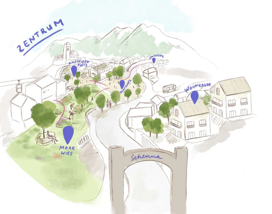
A new joint is proposed between the centralities to connect movement flows along the hillside. The detail plan draws the centre itself: the historic core, Dorfplatz, and the new green space Moarwiese.
Development Proposal Sketches for the New Center
Selected Proposals
Sketching tested how buildings, green space, access, and public ground can be arranged on the same sloping site. Eight arrangements were tried and compared.
Three of them, circled and numbered, were picked and explored further, each as a site plan and a hillside section.
Alternative 1
Residential continuity
- Focuses on residential use.
- Treats the connecting street as a simple connection with intimate public and green space.
- Places mixed uses along the promenade and toward the centres.
Residential continuity: planSaba Seighali with LIA Collective Residential continuity: sectionSaba Seighali with LIA Collective Alternative 2
Views and public interaction
- Focuses on the view and on public spaces for interaction.
- Activates the new green space through mixed use.
- Tests a more urban design with diverse green coverage.
Views and public interaction: planSaba Seighali with LIA Collective Views and public interaction: sectionSaba Seighali with LIA Collective Alternative 3
Structured public realm
- Builds different spaces with multiple qualities, broken down by hierarchy.
- Protects an undisturbed view and open space.
- Creates a central, structured public space, with less focus on residential use and more on public use.
Structured public realm: planSaba Seighali with LIA Collective Structured public realm: sectionSaba Seighali with LIA Collective
Credits
- Urban and landscape planning
- LIA Collective
- Graphics
- Saba Seighali with LIA Collective; the portfolio identifies page 9 as team-work material
- Status
- Work in progress
- Source
- Supplied portfolio PDF, pages 8–10 (printed pages 14, 16, and 18), plus the supplied Schenna project folder